|
|
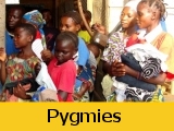
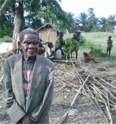
Citizens of the DRC are among
the poorest in the world, having the second lowest nominal
GDP per capita. The Democratic Republic of Congo is the second
poorest country in the world, ahead of Zimbabwe.
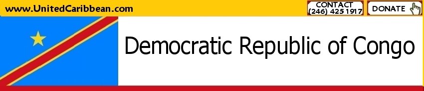
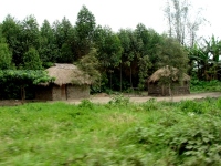
Seen here the Pygmies Chief in his home
village. |

|
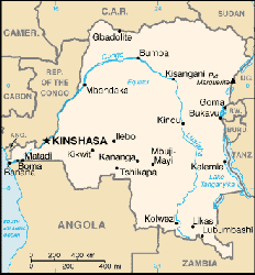
The Congo is situated at the heart of the west-central
portion of sub-Saharan Africa and is bounded by (clockwise from
the southwest) Angola, the South Atlantic Ocean, the Republic of
Congo, the Central African Republic, the Sudan, Uganda, Rwanda,
Burundi, Tanzania across Lake Tanganyika, and Zambia. The country
straddles the Equator, with one-third to the North and two-thirds
to the South. The size of Congo, 2,345,408 square kilometres (905,567
sq mi), is slightly greater than the combined areas of Spain, France,
Germany, Sweden, and Norway.
 |
As a result of its equatorial
location, the Congo experiences high precipitation and has
the highest frequency of thunderstorms in the world. The annual
rainfall can total upwards of 80 inches (2,000 mm) in some
places, and the area sustains the Congo Rainforest, the second
largest rain forest in the world (after that of the Amazon).
|
This massive expanse of lush jungle covers most
of the vast, low-lying central basin of the river, which slopes
toward the Atlantic Ocean in the West. This area is surrounded by
plateaus merging into savannas in the south and southwest, by mountainous
terraces in the west, and dense grasslands extending beyond the
Congo River in the north. High, glaciated mountains are found in
the extreme eastern region.
The previously mentioned Great Rift Valley, in particular
the Eastern Rift, plays a key role in shaping the Congo's geography.
Not only is the northeastern section of the country much more mountainous,
but due to the rift's tectonic activities, this area also experiences
volcanic activity, occasionally with loss of life. The geologic
activity in this area also created the famous African Great Lakes,
three of which lie on the Congo's eastern frontier: Lake Albert
(known previously as Lake Mobutu), Lake Edward, and Lake Tanganyika.
The Rift Valley has exposed an enormous amount of
mineral wealth throughout the south and east of the Congo, making
it accessible to mining. Cobalt, copper, cadmium, industrial and
gem-quality diamonds, gold, silver, zinc, manganese, tin, germanium,
uranium, radium, bauxite, iron ore, and coal are all found in plentiful
supply, especially in the Congo's southeastern Katanga region. |
|